Second Attempt
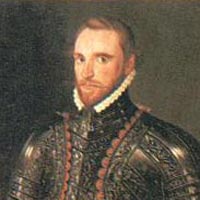
Image of Sir Richard Grenville obtained from: http://www.visitoruk.com/images/bude_sir-richard-grenville.jpg
The second voyage over to the Americas was sent by Raleigh and
led by Sir Richard Grenville in 1585. Ralph Lane was the governor of this colony
(Kupperman, 1984). John White was among one of the people on this voyage who
would later be the leader and governor of the third and final attempt to
colonize Roanoke by Walter Raleigh. John White during this stay in the colony
was there as a painter to record the area and make maps. Thomas Hariot was a
scientist that went on this expedition and recorded his findings about the
resources and natives. He later published some of his findings of America in A Brief and True Report of the New Found Land of Virginia (Kupperman, 1984). Upon arrival, Grenville corresponded
with the Indians who inhabited this small island of Roanoke and agreed upon a
spot for settlement. The location needed to be far enough north so that two
groups of people could live where they would not be too close together and use
up all of each other’s resources (Durant, 1984). Some of the men discovered an
area that came to be known as the Chesapeake Bay. This area was said to be
better for settlement than Roanoke (Durant, 1984). Grenville returned to
England leaving 15 or 16 men behind in the colony. The men were sure that a
more permanent settlement could be established in Roanoke. However, there was
some conflict with the Natives which caused distress during this time (Durant,
1984). During this stay in Roanoke the settlers built a homestead and more
permanent location for survival, even though they did not stay.
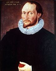
Image of Thomas Hariot obtained from: http://www.trueknowledge.com/images/thumbs/180/250/8b8401bc6af0154fd70c1e9a92745ce1.jpg
John White drew many maps and pictures in Roanoke
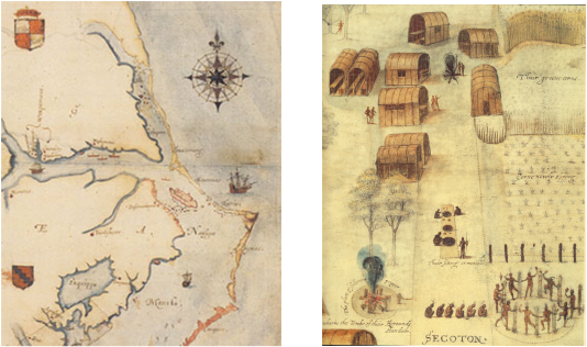
John White Map, Roanoke, 1586
Image obtained from: http://www.uri.edu/artsci/his/mua/images/inthefieldimages/imagesiimr/roanokemap.jpg
Secotan Village in North Carolina. Painted by John White. British Museum London. Obtained from:http://upload.wikimedia.org/wikipedia/commons/c/c6/North_carolina_algonkin-dorf.jpg

"A Cheiff Lorde of Roanoac," Engraving by Theodore De Bry. Created from John White's painting. Image obtained from: http://www.learnnc.org/lp/media/uploads/2007/08/roanoke_lord.jpg
The colony seemed to be very reliant on the help of the Native
Americans in means of farming, hunting and survival. The attitude toward the
settlers was split by the Indians. They were not sure whether to try and live
with them or to defy them. The majority of the time the colonists were there,
they were completely reliant on the Natives for food and farming techniques
(Kupperman, 1984).
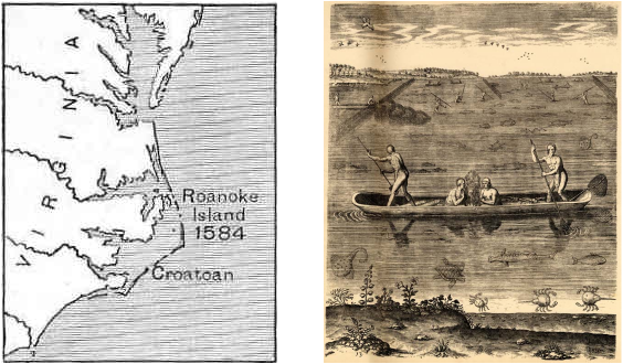
Map showing the location of Roanoke Island and Croatoan Island. Obtained from: http://www.web-books.com/Classics/Books/B1/B1583/MAIN/images/017roanoke.jpg. Image by Theadore De Bry, Nativce Americans Fishing, based off of John White's Drawings Obtained from: http://www.learnnc.org/lp/media/uploads/2007/08/fishing.jpg

The Algonkians method of curing fish. Painted by John White. British Museum in London. Obtained from:http://upload.wikimedia.org/wikipedia/commons/9/9c/North_carolina_algonkin-essen02.jpg
